In the last post, we introduced you to the LiDAR system. Now that we know what it is, let’s understand the power of 3D LiDAR.
Engineers can easily convert LiDAR data into 3D maps to better understand the environment, increasing the economic potential of many projects.
LiDAR systems can take on three types of dimensions: 1D, 2D, and 3D. The most common are 2D and 3D, so these will be our reference points to decide which one is the best.
Let’s start by understanding what a 2D LiDAR is. It’s main characteristic is that it emits a single beam of light towards the target object in a horizontal plane, collecting objective data about the X and Y axes, creating 2D maps of the environment. One of the advantages of these sensors is their size, allowing for easy portability.
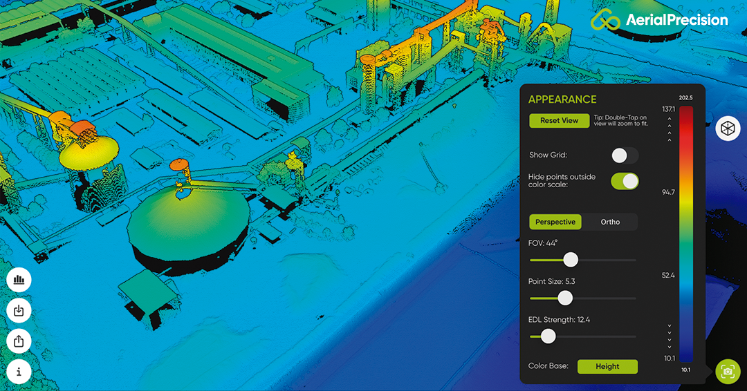
Now let’s understand 3D sensors. Unlike 2D sensors, 3D sensors use a particular type sensor-receiver that rotate 360 degrees and emit multiple beams of light towards the environment to collect points on the X, Y, and Z coordinates. It can accurately determine the depth and elevation angle of the landscape or height structures in the surroundings. It thus provides more detailed and accurate information than 2D systems.
Once we know what each method consists of, we can immediately understand their main differences, the number of light beams emitted, the focus axis during beam emission, and the dimension.
As for its application, the 2D LIDAR system is best suited for activities requiring long-range surface detection due to the horizontal data it can detect. In contrast, 3D LiDAR systems are more suitable for cartography and landscape scanning, or collision protection in automated vehicles, due to the amount of data this model can capture in all dimensions of the space.
We can then conclude that the big winner is 3D LiDAR. It is the most valuable and cost-effective, providing the most detailed and accurate information. And, as we know, Better Information, More Efficiency.