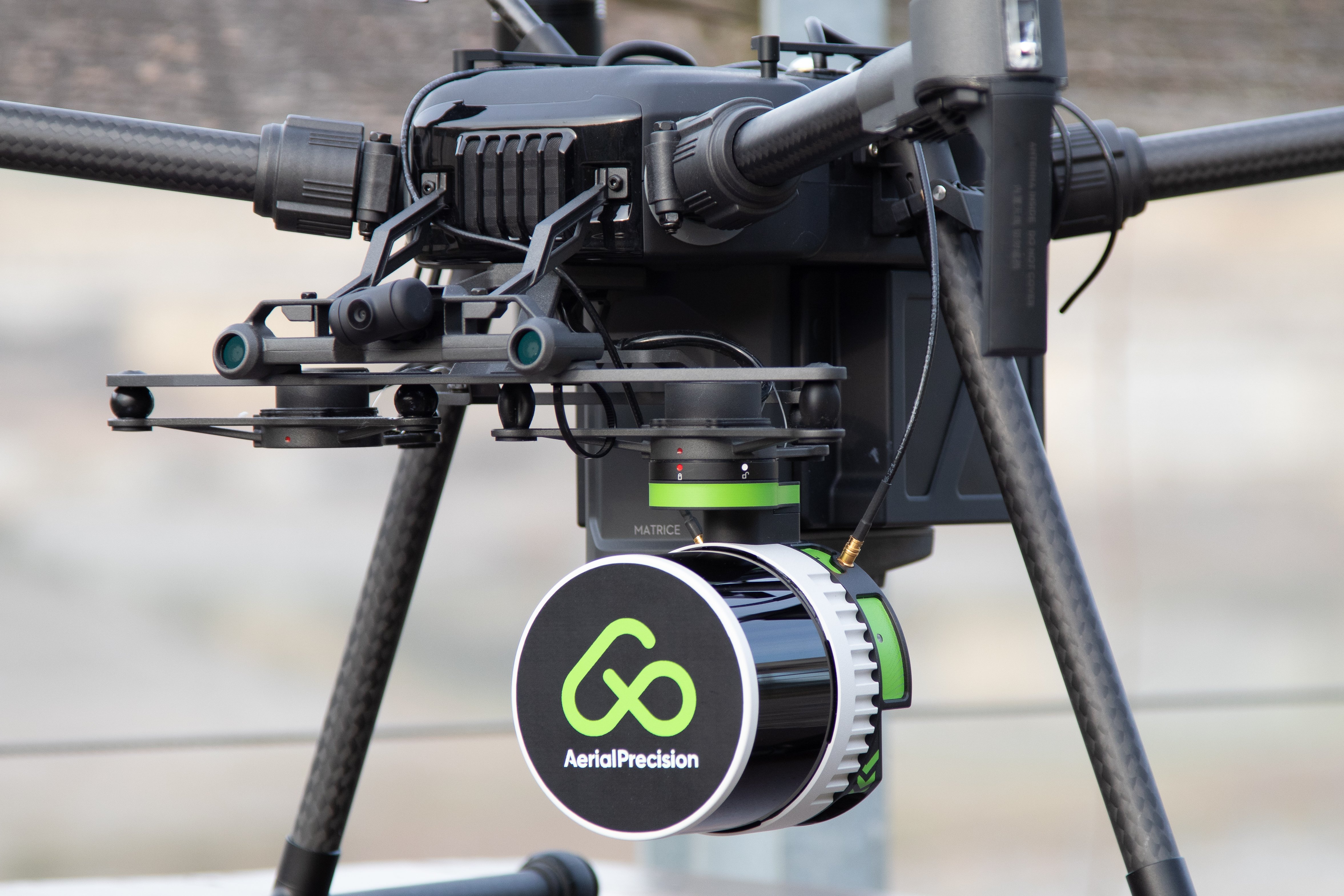
In the ever-evolving landscape of LiDAR technology, precision is the holy grail. One of the pivotal advancements that contribute to achieving unprecedented accuracy is the seamless integration of Global Navigation Satellite Systems (GNSS) with Inertial Measurement Units (IMU), often referred to as Inertial Navigation Systems (INS). Today, we delve into the symbiotic relationship between GNSS and IMU, exploring how this combination elevates the quality of LiDAR sensors. At the forefront of this innovation is AP-LiDAR-One Gen II, which is equipped with a survey-grade GNSS and IMU.
Understanding the Synergy: GNSS and IMU
GNSS: These satellite-based systems, including GPS, GLONASS, and Galileo, among others, provide precise positioning information. However, they face challenges in environments with obstacles or signal interference.
IMU: Comprising accelerometers and gyroscopes, an IMU measures acceleration and angular rate changes. While it excels in dynamic situations, it tends to drift over time.
- Improved Positioning Accuracy: The marriage of GNSS and IMU addresses the shortcomings of each technology individually. When combined, GNSS provides absolute positioning information, while IMU compensates for GNSS limitations in challenging environments. This synergy results in significantly improved positioning accuracy, which is crucial for applications requiring survey-grade precision.
- Continuous Operation in Challenging Environments: Traditional GNSS systems might struggle in environments with obstacles or signal obstructions. IMU comes to the rescue by maintaining accurate positioning data during brief GNSS signal losses. This continuous operation in challenging conditions ensures a seamless and uninterrupted data capture process.
- Reduction of Drift Errors: IMUs, on their own, are prone to accumulating drift errors over time. The integration with GNSS allows for continuous correction, minimizing drift and ensuring that the LiDAR sensor maintains accuracy throughout an entire data capture session.
AP-LiDAR-One Gen II: Setting the Standard for Precision
At the forefront of this GNSS-IMU integration is AP-LiDAR-One Gen II, a LiDAR sensor that goes beyond industry standards. Equipped with a survey-grade IMU, it sets a new benchmark for precision in spatial data capture. Here's why AP-LiDAR-One Gen II stands out:
- Unparalleled Precision: The survey-grade IMU ensures that each data point is captured accurately.
- Continuous Performance: With the combination of GNSS and IMU, AP-LiDAR-One Gen II operates seamlessly in various conditions, providing consistency and uninterrupted data capture.
- Minimized Drift: Drift errors are minimized, thanks to the precision correction facilitated by the survey-grade IMU, resulting in survey-grade quality data.
In conclusion, combining GNSS and IMU represents a paradigm shift in LiDAR technology. It's a marriage of strengths that addresses individual weaknesses, resulting in unparalleled precision. AP-LiDAR-One Gen II, with its survey-grade IMU, stands as a testament to the relentless pursuit of excellence in spatial data capture.
As we progress, this integration redefines what's possible in LiDAR technology. AP-LiDAR-One Gen II is not just a sensor; it's a commitment to setting new standards.