


How Cloud Solutions Are Killing Efficiency in the Surveying and Mapping Industry?
Ana Rouxinol
The surveying and mapping industry relies heavily on LiDAR technology, generating critical point clouds for accurate analysis and decision-making. However, cloud-based solutions, often considered a convenience, are proving to be a bottleneck in this fast-paced field.
One of the most significant issues? The time it takes to upload large LiDAR point clouds to the cloud, even on cutting-edge networks like 5G. Let's explore why cloud solutions are killing efficiency and how on-site processing provides a superior alternative.
The Data Challenge: Why Cloud Uploads Are a Bottleneck
The Reality of Uploading Large Files
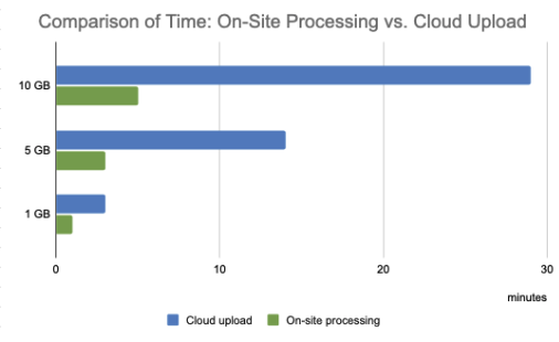
LiDAR point clouds are enormous ( an average dataset can easily reach 10GB or more). So, how long does it take to upload a file this size to the cloud?
Even with 5G, which offers theoretical upload speeds of 10-50 Mbps for many users (and up to 100 Mbps in optimal conditions):
- At 10 Mbps (common real-world speed): Uploading a 10GB file takes over 2 hours.
- At 50 Mbps (ideal conditions): It still takes about 30 minutes.
- At 100 Mbps (rare maximum): Upload time is approximately 15 minutes.
These times don't even account for real-world factors like network congestion, remote locations, or unstable connections, all of which can make upload times significantly longer.
Why This Kills On-Site Efficiency
In the field, time is critical. Waiting 15-30 minutes (or longer) just to upload one dataset defeats the purpose of on-site processing. If you're in a remote area with poor 5G or LTE coverage, these upload times can stretch into hours or become impossible.
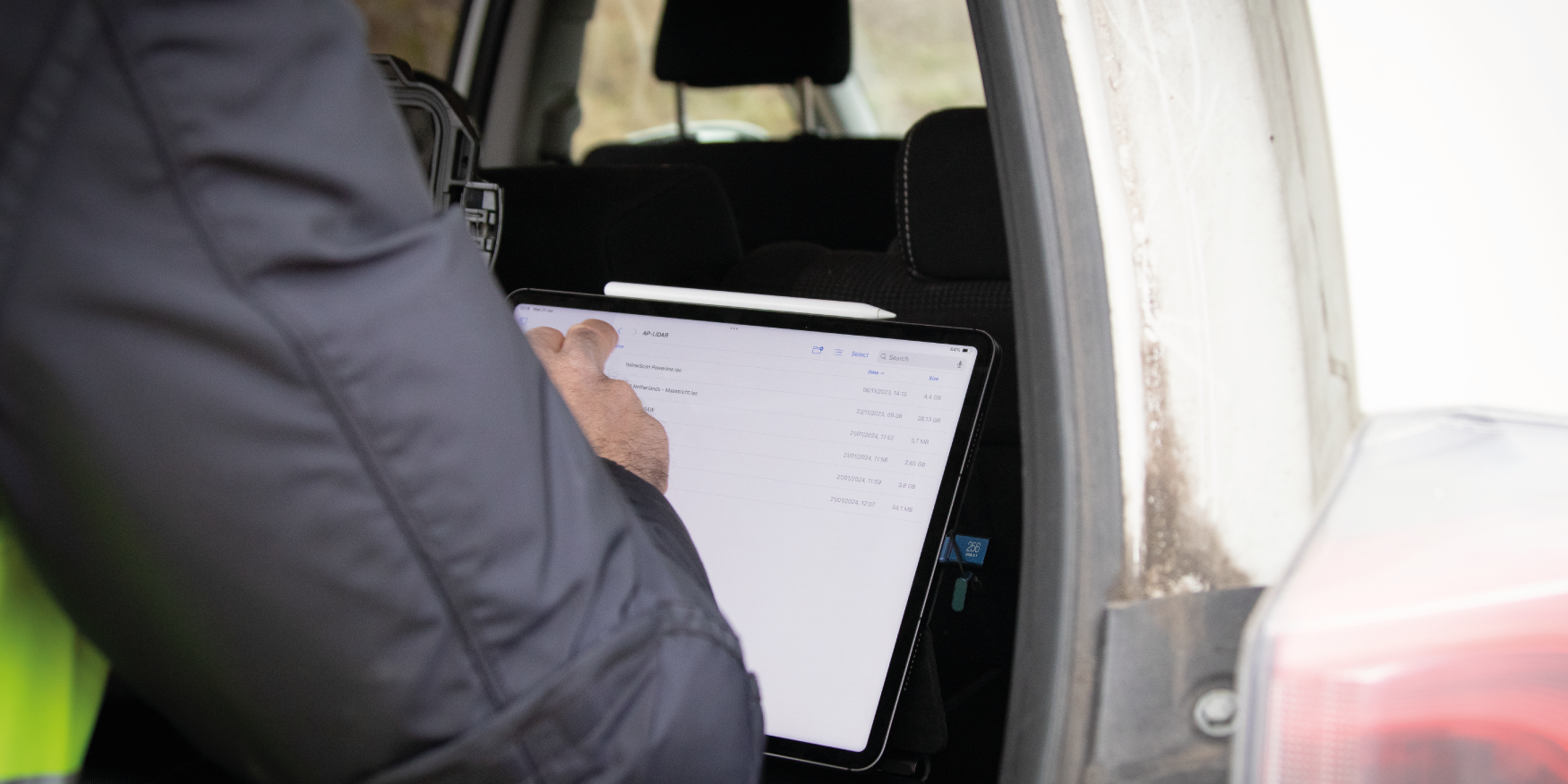
In contrast, on-site processing lets you skip the upload entirely, turning raw data into actionable insights in minutes.
Data Privacy Concerns: Who Owns Your Data?
Beyond inefficiency, cloud solutions raise serious concerns about data privacy. When you upload point clouds to the cloud, you may lose control over who can access the data. Questions to consider:
- Who owns the data once it's uploaded?
- How secure is the data during transfer and storage?
- Are there restrictions on what can be shared or stored?
These concerns are significant for industries handling sensitive information like government projects or urban infrastructure.
Efficiency vs. Convenience: The Case for On-Site Processing
The promise of cloud-based solutions is often the convenience, but the reality is far from it. With on-site processing:
- You avoid lengthy upload times entirely.
- You don't need to depend on unstable or unavailable internet connections.
- You retain complete control over your data without compromising privacy.
Most importantly, on-site processing lets you turn raw data into results faster without sacrificing quality.
We've Got Your Back: Aerial Precision's On-Site Solution
At Aerial Precision, we recognize the inefficiencies of cloud-based systems and offer a game-changing alternative: on-site LiDAR data processing.
- No Uploads Needed: Process data instantly in the field, even in remote locations with no internet.
- Privacy First: Your data stays with you. No third-party access or storage.
- Fast, Seamless Results: Produce survey-grade accurate point clouds in minutes, not hours.
The Future of Surveying Is On-Site
Cloud-based solutions promise convenience but often fail to deliver efficiency, especially when uploading large LiDAR datasets in real-world conditions. On-site processing offers a faster, more reliable, and more secure alternative, enabling you to maximize productivity without unnecessary delays or risks.
Why waste time in the cloud? Switch to Aerial Precision's on-site processing solution and experience efficiency like never before. Contact us today to learn more!


