

BLOG

LiDAR software: the hidden costs that slow you ...
Discover the hidden costs and workflow challenges of LiDAR software, and how FLUX and Flow App provides a flexible, transparent solution.
LiDAR software: the hidden costs that slow you ...
Discover the hidden costs and workflow challenges of LiDAR software, and how FLUX and Flow App provides a flexible, transparent solution.

On-site point cloud processing on iPad and iPhone
At Aerial Precision, we introduced the idea of processing point clouds on-site using mobile devices. At first, many professionals doubted it. The conventional model: capture in the field, upload, then...
On-site point cloud processing on iPad and iPhone
At Aerial Precision, we introduced the idea of processing point clouds on-site using mobile devices. At first, many professionals doubted it. The conventional model: capture in the field, upload, then...

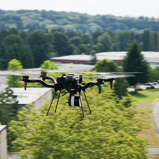
Unveiling FLUX: Freefly's groundbreaking first ...
Freefly Systems introduced FLUX, its first LiDAR solution. This launch represents a significant advancement for the mapping and surveying community. FLUX is designed to deliver exceptional simplicity, speed, and accuracy,...
Unveiling FLUX: Freefly's groundbreaking first ...
Freefly Systems introduced FLUX, its first LiDAR solution. This launch represents a significant advancement for the mapping and surveying community. FLUX is designed to deliver exceptional simplicity, speed, and accuracy,...

Do tectonic plates and earth's rotation affect ...
Although tectonic plate movement and variations in Earth's rotation occur slowly, their effects accumulate over time. For high-precision LiDAR mapping, even a few centimeters of drift or microseconds of timing...
Do tectonic plates and earth's rotation affect ...
Although tectonic plate movement and variations in Earth's rotation occur slowly, their effects accumulate over time. For high-precision LiDAR mapping, even a few centimeters of drift or microseconds of timing...
Aerial Precision and Freefly Systems Join Force...
Aerial Precision is excited to announce our groundbreaking partnership with Freefly Systems, a leading innovator in drone technology, setting the stage for an exhilarating new era in aerial mapping!
Aerial Precision and Freefly Systems Join Force...
Aerial Precision is excited to announce our groundbreaking partnership with Freefly Systems, a leading innovator in drone technology, setting the stage for an exhilarating new era in aerial mapping!

Understanding LiDAR returns: what 'Up to 5 Retu...
When evaluating a LiDAR sensor, one of the first specifications that often stands out is the number of returns it supports. Some sensors advertise "up to five returns per pulse,"...
Understanding LiDAR returns: what 'Up to 5 Retu...
When evaluating a LiDAR sensor, one of the first specifications that often stands out is the number of returns it supports. Some sensors advertise "up to five returns per pulse,"...