

WANT TO LEARN MORE?
View all-

LiDAR software: the hidden costs that slow you ...
Discover the hidden costs and workflow challenges of LiDAR software, and how FLUX and Flow App provides a flexible, transparent solution.
LiDAR software: the hidden costs that slow you ...
Discover the hidden costs and workflow challenges of LiDAR software, and how FLUX and Flow App provides a flexible, transparent solution.
-

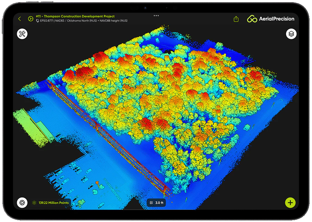
On-site point cloud processing on iPad and iPhone
At Aerial Precision, we introduced the idea of processing point clouds on-site using mobile devices. At first, many professionals doubted it. The conventional model: capture in the field, upload, then...
On-site point cloud processing on iPad and iPhone
At Aerial Precision, we introduced the idea of processing point clouds on-site using mobile devices. At first, many professionals doubted it. The conventional model: capture in the field, upload, then...
-

Unveiling FLUX: Freefly's groundbreaking first ...
Freefly Systems introduced FLUX, its first LiDAR solution. This launch represents a significant advancement for the mapping and surveying community. FLUX is designed to deliver exceptional simplicity, speed, and accuracy,...
Unveiling FLUX: Freefly's groundbreaking first ...
Freefly Systems introduced FLUX, its first LiDAR solution. This launch represents a significant advancement for the mapping and surveying community. FLUX is designed to deliver exceptional simplicity, speed, and accuracy,...


